What has been done so far?
For over twenty years, various organizations have documented serious water flow challenges in the Cowichan watershed, and called for improved water storage to protect environmental values. Thanks to funding provided by senior levels of government, local partners (Cowichan Tribes, CVRD, Catalyst Crofton, and the Cowichan Watershed Board) have now been able to complete the following necessary steps to define and design a solution:
a) 2017-18 – Leading a community planning process (Water Use Plan);
b) 2019-2021 – Engineering a Weir Design to implement the consensus recommendations of that process, and;
c) 2022 – Completing a shoreline assessment to understand the new weir design’s potential impact, and publishing a property view tool to demonstrate these modelling results at any lakeshore address.
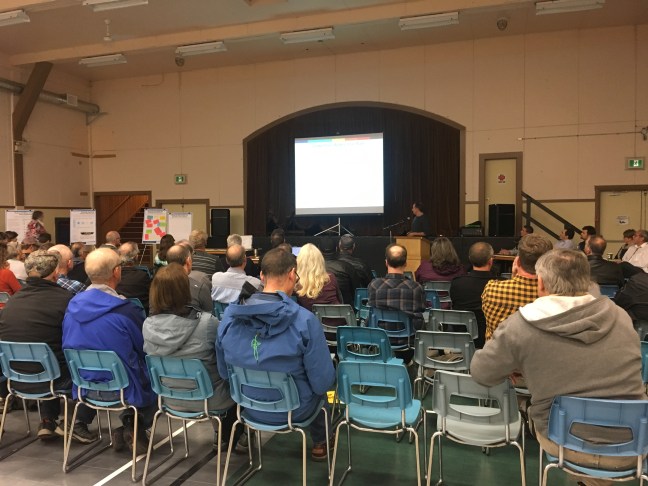
Learn more about this important planning work below. You can also read the project engineer’s updates throughout the design phases under Leroy’s Corner.
Current status: The project partners are now working towards submitting an application to the Province for a water conservation license, and permission to construct the new weir as planned.
Water Use Plan
The Cowichan Valley Regional District (CVRD), Cowichan Tribes, the Cowichan Watershed Board, and Catalyst Paper partnered together to initiate a community planning process that explored future water use needs alongside a range of different potential water supply and storage options. The outcome was agreement on a long-term solution to better ensure water resources are sustainable and available to meet the region’s future water use requirements.
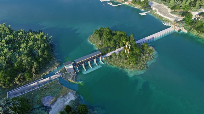
Cowichan Lake Weir Design
The key recommendation of the Water Use Plan is to construct a new weir for Cowichan Lake with an increase of 70 cm of elevation above the existing weir.
(Click image for a video rendering of the new weir design.)
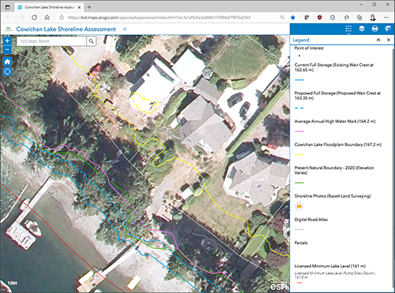
Shoreline Assessment & Property View Tool
A condition of the recommendation to construct a new weir is that an assessment be done of the potential impact on the lake’s natural boundary due to the additional storage required to meet future needs.
(Click image to open the Property View Tool or start here for full instructions.)
