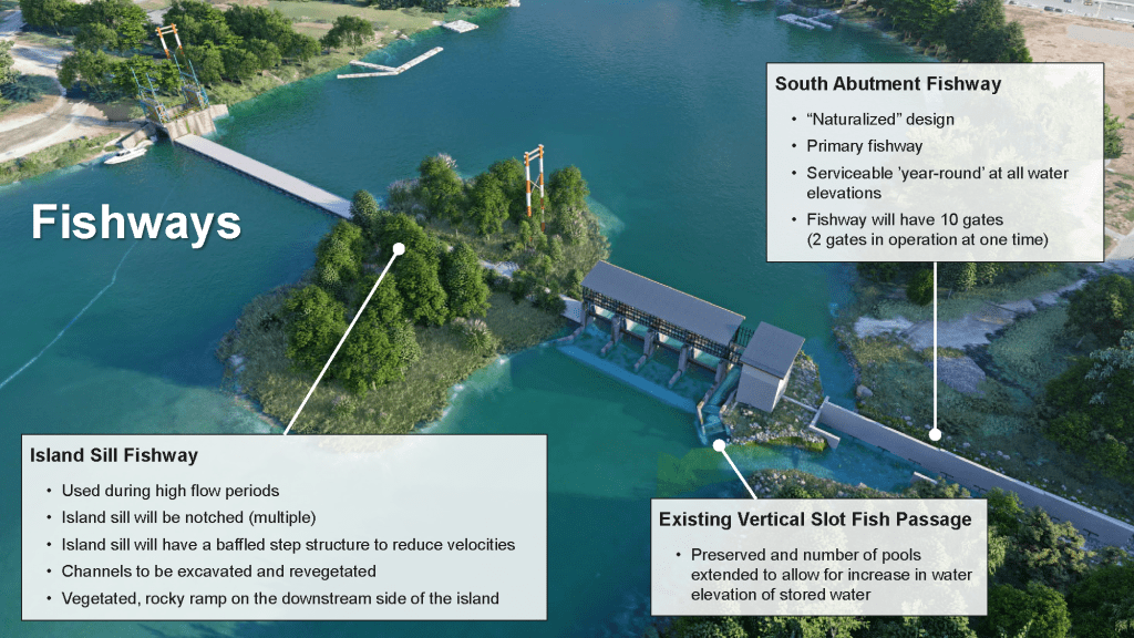
[Completed 2021] The final design is based on recommendations from the 2018 Cowichan Water Use Plan (WUP), stakeholder engagement, feedback on the preliminary design, Provincial and Federal legislation and industry accepted practices. Fish passage and riparian environment objectives are the priority in the design and the basis for the project funding.
This project is managed by the CVRD and is made possible through the generous support of the British Columbia Salmon Restoration and Innovation Fund (BCSRIF).
A video of the presentation of the Final Weir Design is available on the July 8 2021 Project Update page.


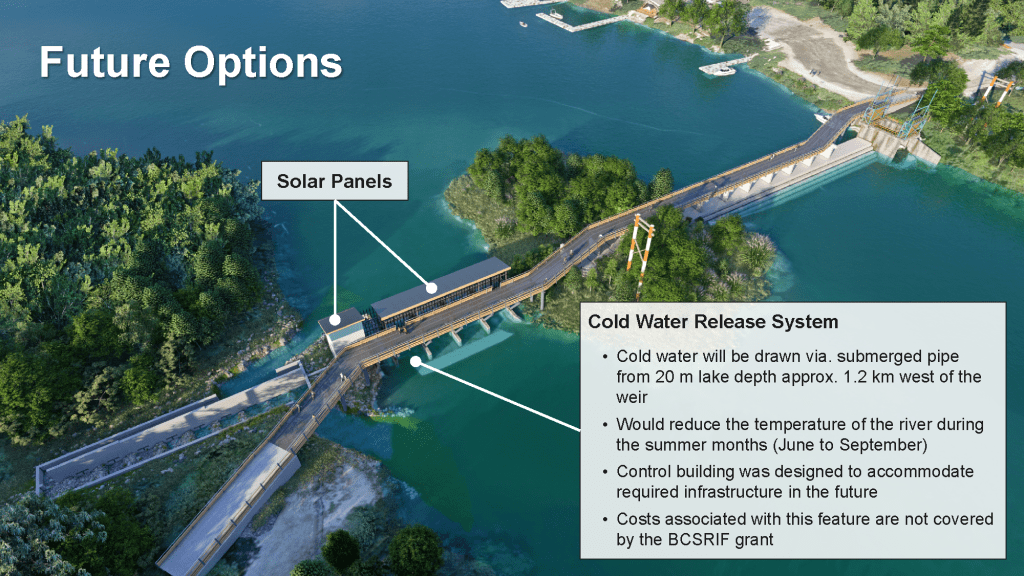
Although not within the funding mandate of the BCSRIF grant, the preliminary design of a new walkway was included in an expanded scope for this project. The design of the new weir can accommodate the walkway in the future.
Datum Update
Government of Canada’s Canadian Geodetic Survey (CGS) maintains and updates standards used to reference positions (latitude, longitude and height) and gravity.
In 2015, Canada adopted a new height reference system: Canadian Geodetic Vertical Datum of 2013 (CGVD2013) which corrects for systematic errors in old datum, and is realized by a geoid model instead of a network of benchmarks whose heights are measured by levelling. A geoid model is a model of global mean sea level that is used to measure precise surface elevations.
More information is available on the Government of Canada website.
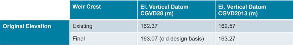
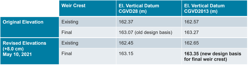
References to date have been using the Canadian Vertical Geodetic Datum (CVGD) from 1928, but references are now being shifted to the more recent CVGD from 2013.
There is a +0.20 m difference between the two datums, but absolute numbers do not change.
For example, the weir height has always been referenced at 162.37 m (CVGD28) but is now referenced at 162.57 m (CVGD2013), but the actual weir has not changed.
Survey Update to Data
Stantec undertook a 3D Laser Scan survey of the project area in late April.
The survey concluded the following:
- The existing weir crest elevation is +8.0 cm higher than the 162.37 m CGVD 28 indicated in past documentation.
- The current data sets must be vertically adjusted to match the updated benchmark.
To learn more about what a geoid model is visit the National Ocean Service webpage, What is the geoid?