Have a question? Enter it at the bottom of this page in the comments area.
We will answer questions during the live presentation on December 10, 2020.
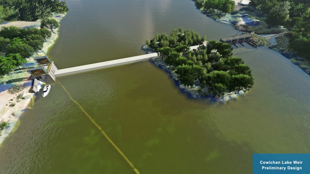
The preliminary design is based on recommendations from the 2018 Cowichan Water Use Plan (WUP), stakeholder engagement, Provincial and Federal legislation and industry accepted practices. Fish passage and riparian environment objectives are the priority in the design and the basis for the project funding.
This project is managed by the CVRD and is made possible through the generous support of the British Columbia Salmon Restoration and Innovation Fund (BCSRIF).
More information will be posted in the following days.
Please join us for a live presentation on December 10, 2020.
Presentation: 6 to 7 PM
Q&A: 7 to 8 PM
Online public link:
https://cowichanvalleyrd.webex.com/cowichanvalleyrd/onstage/g.php?MTID=ef3b29b2c638a185fa0773f84c5c7ebaf
Call-in number: 1-844-992-4726
Call-in access code: 146 385 7474


Have a question? Enter it at the bottom of this page in the comments area. We will answer questions during the live presentation on December 10, 2020.
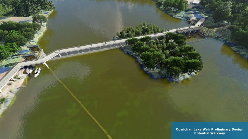
We are currently exploring the option of a walkway over the weir. Further analysis is required to determine the feasibility of this option.


When I want to add boulders to protect my property from erosion from high lake levels I have to get a Riparian Assessment. Has a Riparian assessment been done of the entire lake to determine the effects of a higher lake level?
The Cowichan has been designated a “Canadian Heritage River.” Here’s a quote from the Canadian Heritage Rivers System: “Canada’s Heritage Rivers are recognized nationally for their outstanding NATURAL, CULTURAL, and RECREATIONAL heritage…” Early in the process of designing the Weir, there was a Public Advisory Group tasked with establishing initial parameters for the Design — were all three Heritage River criteria considered in that initial process? Were there representatives included in the Public Advisory Group to advocate specifically for all three criteria? And have features been specifically included in the current design to honour those criteria?
There was previous support expressed by paddlers to explore the possibility of creating whitewater features into the weir design. I don’t see any elements in this information regarding incorporating whitewater play features. Can these features be incorporated. Looking forward to hearing more on Thursday
Hello– This is àn opportunity to include paddle sports in the mix: for locals and for tourists these are attractions. Why isn’t there a paddling play park in the plans?
With a project of this magnitude, the overall impacts on the community will be lasting and probably profound. From what I understand, recreational values are appreciated by the planners but the funding for this is not easily obtained, and at this point may not be available. It seems a shame to not take the time to do this right the first time. Other communities are dealing with aging infrastructure, and so many (eg Boise ID, Bend OR, Oklahoma City, Ottawa ON and many more) have incorporated whitewater kayaking features, extensive trail networks, riverside recreational sites of interest, etc and these have helped those communities create economic opportunity, have had positive influence on fish habitat, and have positively impacted resident quality of life. I would love to see this happen in this case as well.
It would be GREAT if some recreational whitewater play features could be included. These kinds of features (e.g. a surf wave) have been very popular in other locations where they have been built. They provide a hub for fun, and for learning, and they draw people to the area thus providing potential economic activity (restaurants, equipment rentals, lessons, etc.)
The current weir has been mismanaged in recent years. All the winter water has been allowed to drain out causing a (false) drought in the summer and fall months. What assurances do lakefront property owners have that there will be someone properly managing the lake level to ensure that there is enough room in the lake for the fall and winter rains. Lake level management is a 24/7/365 job. Will the management of the new weir recognize that fact? What will be done for property damage due to the 27 inch increase of the weir. How will the government compensate lakefront owners for encroaching on their land and will there also be retroactive compensation for the initial installation of the weir which was promised and never realized?
Just wanted to confirm that this is a weir not a dam. So at what water level will the water flow over the top of the weir?
There was strong support expressed by responents to the weir design survey for investigating possible ways to enhace paddlesport activities as part of the new weir design exercise. Was this done? And if not ( I don’t see any elements in this report so far) can further design work be done once the basic structure is finalised? Looking forward to hearing more on Thursday.
A question — Historically, weirs elsewhere have earned reputations as “drowning machines” because when water flows over the top, it forms a dangerous hydraulic at the base. Anyone who drifts over the top of the weir, or floats/boats up to the base of weir, would be trapped in the recirculating hydraulic. Will our new weir include design features which will ensure safety?