Have a question? Enter it at the bottom of this page in the comments area.
We will answer questions during the live presentation on December 10, 2020.
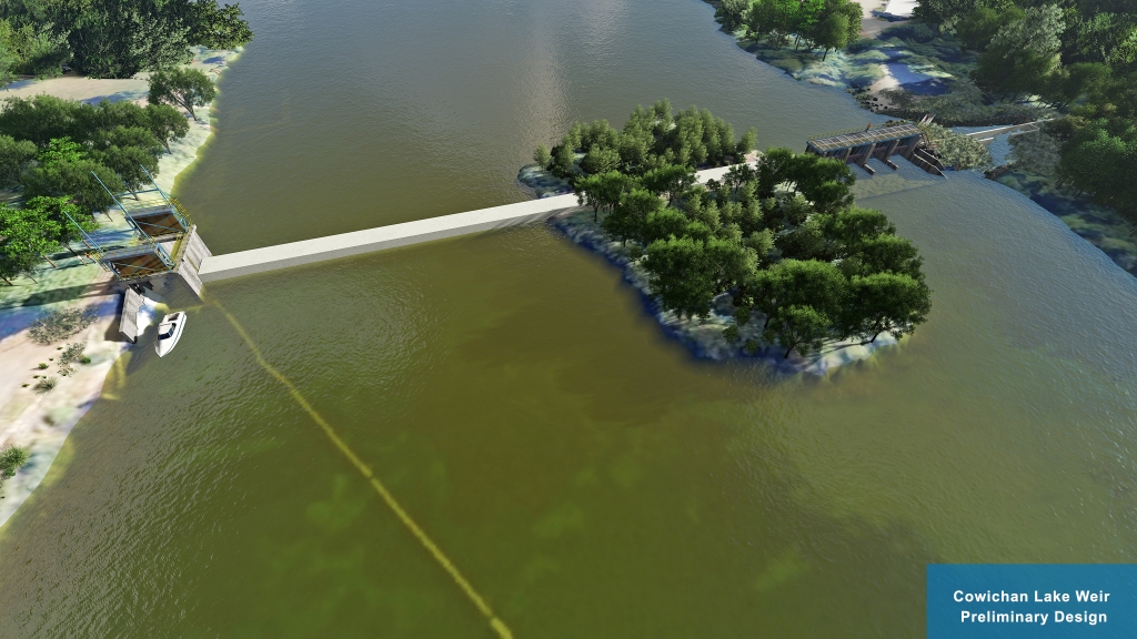
The preliminary design is based on recommendations from the 2018 Cowichan Water Use Plan (WUP), stakeholder engagement, Provincial and Federal legislation and industry accepted practices. Fish passage and riparian environment objectives are the priority in the design and the basis for the project funding.
This project is managed by the CVRD and is made possible through the generous support of the British Columbia Salmon Restoration and Innovation Fund (BCSRIF).
More information will be posted in the following days.
Please join us for a live presentation on December 10, 2020.
Presentation: 6 to 7 PM
Q&A: 7 to 8 PM
Online public link:
https://cowichanvalleyrd.webex.com/cowichanvalleyrd/onstage/g.php?MTID=ef3b29b2c638a185fa0773f84c5c7ebaf
Call-in number: 1-844-992-4726
Call-in access code: 146 385 7474


Have a question? Enter it at the bottom of this page in the comments area. We will answer questions during the live presentation on December 10, 2020.
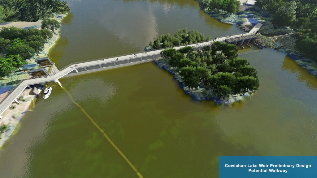
We are currently exploring the option of a walkway over the weir. Further analysis is required to determine the feasibility of this option.


The boat launch is planned to stay exactly where it is today. It may be impacted during some of the construction period due to laydown yards and work activity.
where’s the boat launch?
The winter high water levels should not be any different after a new weir is built. During high water levels the water will flow over the new weir as it does today with the existing weir. The river valley downstream of the weir controls the lake level once the weir is overtopped. The highest water level measured in 1968 was 165.39 meters elevation.
Where the water is on the shoreline is depends on time of year and precipitation.
I need to replace 1 of my pilings and am wondering how far the water will be coming in on shoreline after weir is complete
The Shoreline Assessment Project is the project set out to determine the impact of a new weir and is scheduled to be complete by mid 2022. This work is meant to inform the future new water license holder of the whole picture before applications or approvals. No construction nor new water licenses will be approved until a full understanding is reached.
The current water level is at around 164 meters elevation which is the average high water mark that has been measured for the past 40 years.
The weir is submerged every winter and does not restrict flow. It is the natural river features downstream of the weir that restrict flow in the winter and determines the high lake levels. The new weir at 163.07m elevation would also be submerged during the high winter water events.
Wow. Compensation, if any??? The water is being stored on lakefront property owners’ property. I think that before anything is started there had better be a very full understanding of the impact of the raising of the weir into a dam. Currently the water level in the lake is lapping at our home foundations. If it goes much higher and a storm similar to December 2019 occurs we will no longer have a home. I know there are many lakefront property owners who will be adversely affected by high water levels.
A pedestrian walkway is a must and should be included in all aspects of the design.
It’s great to see the preliminary designs for the new weir! From a landscape architecture perspective, I can see the huge benefit of incorporating public engagement with a walkway, benches, viewing platform etc. I’m sure you have a growing list of desired features from the community, as I can see the white water element being particularly sought after. I am wondering what measures have needed to be taken place in the great effort of constructing the new weir and removing the old one in regards to ecological impact and concerns? In particular, the Cowichan Lake Lamprey’s critical habitat falls within this realm. I’m also wondering if the designers have explored any material elements such a textured panels and shelves to create opportunity/habitat for other species as well? An example of this is the Seattle Seawall design in Elliot Bay. There is a chance for this project to be multifunctional, therefore serving more ecosystem services, and providing space for wildlife and humans. Thanks for your feedback, and Happy New Year!
Modelling will be completed as part of the Shoreline Assessment project to be completed by mid 2022. The new weir shouldn’t impact the high winter water levels because once the weir is overtopped, the flow (and thus lake elevation) is then controlled by the narrow river valley by the Greendale Trestle.
You were too quick onto the website and hadn’t included that picture yet. We are designing a walkway into the project as an option. Ultimately it will be up to the new owner/water license owner to decide whether or not to include one.