Frequently Asked Questions
What is “the weir”?
The Cowichan Lake weir is a type of dam that stores water for about half of every year to keep the iconic Cowichan River — a Canadian Heritage River — flowing during the dry season. With climate change, the weir has become a critical piece of infrastructure to protect the ecological health of the Cowichan River and its surrounding watershed. Learn more about how it functions and how that helps wild salmon, the environment, the BC economy, and local communities here.
The weir is visible from the Town of Lake Cowichan, stretching across the lake at the location where it empties into Cowichan River. As shown in the image, the weir is actually comprised of five sections:
- a boat lock, which allows boats to pass through,
- 97 cm high dam (weir), which is a rock-filled sheet pile structure with a concrete top,
- a natural island, with a small concrete beam across it, maintaining a level height,
- a set of four floodgates (or spillgates) which open and close to control flows of water from the lake into the river, and,
- a small fish ladder, which allows fish to pass between the river and the lake, adjacent to the floodgates.
The current weir was built in 1957 by the operator of the downstream Crofton pulp mill, under a Provincial water license. That license sets out conditions to protect the environment, including that the operator must manage water storage and flows to meet a schedule of minimum flow rates so that mill’s water use doesn’t negatively impact the ecological requirements of fish and other species in the river. The water stored by the weir must be enough to sustain water flows from spring to fall for both the mill and the river. The existing weir worked well for about 50 years to accomplish that, and in fact, for the majority of the river that is above the mill’s intake pipe in Duncan, there is better summer and fall river flow than if the weir didn’t exist. However, in the past two decades, due to decreased flows into the lake in spring and summer, water storage volumes in the lake are no longer sufficient.
Note that the term ‘weir’ has long been used on the Cowichan River to mean fishing weirs. Elders tell us about a time when the river was the primary food source for Cowichan People. A sophisticated network of fishing weirs, including tidal weirs, river weirs, and rock weirs, was used to sustainably catch fish, primarily salmon, throughout Quw’utsun territories. (Source: Daniel Marshall Those Who Fell from the Sky, 1999). To be clear, the weir at Cowichan Lake is a water storage technology, and not a fishing weir.

How does the weir work?
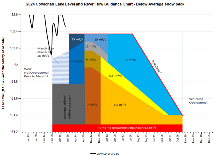
The current weir is owned by Domtar/Catalyst Crofton, a pulp mill located at the tideline in Crofton, and operated under a Provincial license. Under that license, Domtar is required to manage water storage and flows to sustain minimum flow rates in the river according to seasonal schedules. These flow rates are determined based on ecological requirements for fish and other species in the river. Those rates are shown along the red ‘rule curve’ line in the chart below. (Everything shown below the red line depicts guidelines for what flows to maintain in drought years, when there is insufficient water.)
For about half of the year, during higher water, the spill gates and boat lock (see above) are opened fully, and the dam is often submerged. During this time, the weir is considered “off-control”, meaning it is not controlling water levels.
During the other half of the year (the dry season from spring to fall), the weir is “on control”, meaning that it is being used to control the rate of water outflow from the lake to the river. During this time, the boat lock is closed except to allow boats to pass. The spill gates are partially closed, restricting water flows to meet a schedule set by the Province, as a requirement of the water license.
Learn more at How the Weir Helps.
Why do we need to replace it?
For the first fifty years after the existing weir was built, the water stored by the weir allowed the operator (Crofton mill) to meet the river flow schedule that is required under its water license every year. There was consistently enough water for both the mill and the recommended flows for a healthy aquatic ecosystem.
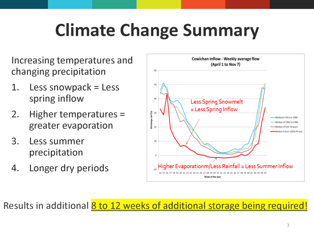
Today, climate change is dramatically affecting the health of the Cowichan watershed. For the past twenty years, more often than not, drought conditions have meant that the current weir has not been high enough to store the water needed to maintain recommended river flows during Cowichan Region’s longer, hotter, drier summer and fall seasons.
During drought, the river becomes shallow and warm, creating conditions that are unsafe for swimming, deadly to salmon and other species, and detrimental to industry due to the need to curtail water use. It was under these conditions in July 2023 that over 100,000 fish perished, including 84,000 juvenile steelhead trout. In 2019 and 2023, massive electric pumps had to be mobilized at significant cost to sustain late summer flows in the Cowichan River.
After 70 years, it is simply time to update this important infrastructure for the health of our watershed and environment, and everyone and everything that relies on that. The additional 70 centimeters (about 2.3 ft) of height that the new weir will provide will greatly improve water storage, meaning there will be more water available during drought conditions to maintain healthy river flow rates.
How will the proposed new weir improve upon the current one?
The key features of the proposed project that will address issues with the current weir are:
- Height – the new weir is designed to be 70cm or 2’4” taller. While this might not seem like much of a change, in a big lake like Cowichan Lake, a little height stores a lot of volume! The additional water storage would provide up to 70 more days of water flow at the minimal recommended flow rate. (Seven cubic meters per second – picture roughly 30 big bathtubs full of water flowing past every second for 70 days!)
- Additional fishways – the new design offers improved fish passage in both directions at all times.
- Upgraded mechanical and electrical components for the boat lock and gate controls.
Optional additional improvements, unnecessary for the weir to function, have been included in the design, and could be added either at the time of construction, or later, if resources allow:
- A pedestrian walkway along the top, linking the north and south parts of town, and
- A cold-water release system to reduce downstream temperatures, which can be beneficial to ecological functions of the river.
Find images and video renderings of the new weir design, with and without various optional components here: https://cowichanlakeweir.ca/final-weir-design/ Note that at the request of the whitewater paddling community, the project engineer also considered the feasibility of including a wave feature in the design of the new weir. Unfortunately, after addressing the key purpose of the weir, which is to provide water supply for environmental purposes, it was determined that adding a wave feature wasn’t feasible. The engineer’s memo on this question is posted here.
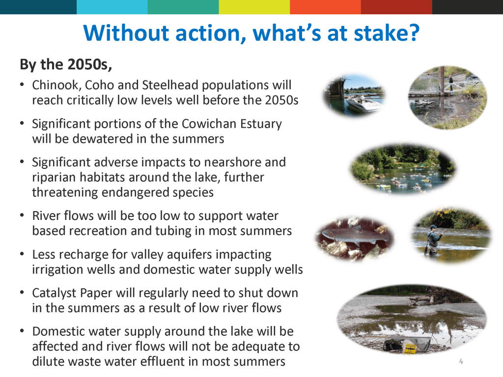
What would happen if we did nothing? What’s at stake?
This question was examined by a Public Advisory Group (PAG) and the supporting consultants during the Cowichan Water Use Planning process, in 2017-2018. Here are some of the materials from that process which capture key anticipated impacts. The bottom image compared potential impacts first from a higher weir, then from keeping the current weir. The PAG concluded with a consensus that a higher weir was necessary. Learn more here.


What if I have a concern about the proposed weir?
As was the case for the current weir, a new weir will require approval via the issuance of a license under the Water Sustainability Act prior to construction. The Province will be responsible for review and consideration of the license application according to the rules and guidance provided in the Water Sustainability Act and Water Sustainability Regulation. The proposal will also need to comply with Federal and Local Government requirements.
One or more of the project partners will submit the license application based on the weir design that has been presented to the community. After the application for the new weir is submitted, a notification will be issued to all parties who may be impacted by the project, including lakeside property owners. The notification process is designed to provide an opportunity for potentially impacted parties to provide feedback and identify concerns which may be required to be addressed by the applicant through mitigation or compensation actions.
More information about the water license process can be found here. https://www2.gov.bc.ca/gov/content/environment/air-land-water/water/water-licensing-rights/water-licences-approvals
Who is leading the project?
Cowichan Tribes First Nation, Cowichan Valley Regional District and the Cowichan Watershed Board are leading the project to replace the weir. The current weir owner, Domtar/Catalyst Crofton, is collaborating to transition to a new weir, under new ownership.
Collaborative discussion and research are ongoing about the best scenario(s) for managing the ownership, license and operational responsibilities for the new weir. This information will be included in the application to the Province for a Conservation Water License.
Financial and other supports are provided by the Province of BC and the Government of Canada.
Are there considerations for any species at risk?
Yes! The Cowichan Lake Lamprey is a truly unique fish, that lives only in Cowichan, Mesachie and Bear Lakes, and portions of key rivers and tributaries flowing into these lakes. It dates back at least 350 million years! It is listed under Canada’s “Species At Risk Act” (SARA) as a threatened species and as such, has protections under the Act. As of February 2020, the habitat critical for their survival also became protected. It is believed that maintaining lake levels, and avoiding pumping water out of the lake, will benefit the lamprey’s shallow shoreline habitats. To learn more, see https://species-registry.canada.ca/index-en.html#/documents/3326.
If I’m a lakeshore resident, what changes should I anticipate along our shoreline?
Both the existing weir and the new weir are designed to reduce the low water impacts (i.e. summer drought), without increasing high water impacts (i.e. winter flooding).
The main change that most lakeshore residents would likely notice if the weir was built as planned, would be that the shoreline they are used to seeing in early summer (April-June) would be higher than usual. It would still be well below winter high-water levels, but higher than residents are used to for that time of year. This is because the goal of the project is to store an additional 70 cm of water (about 2.5 feet) in the lake in the spring, so that water reserves will last until late summer and fall.
Lakeshore residents can also expect to experience fewer years with very low lake levels, as has often been the case lately in the summer or fall.
High water levels are not affected by the current weir, and similarly would not be significantly affected by the new weir. During the rainy season (winter), the weir gates and boat lock are left fully open and water flows through them and over top of the weir. What slows water outflows in winter is the size and slope of the river. A narrowing of the river downstream restricts the outflow, at a place called the Greendale “pinch point”, visible from Greendale trestle. Learn more about how the weir works here.
Modelling for the new higher weir design indicates that average high-water levels would not change by more than 2.5 inches. How any additional lake height would affect each beach and shoreline will be variable, so a Shoreline Assessment was completed to model that question, and an online tool has been made available for residents to look up the modelling for their address. Please see the Property View Tool on our website. If you need help with that, please email weir.here@cowichanwatershedboard.ca.
For the majority of properties, the Assessment concluded that there is no increased risk of flooding. As Cowichan Lake residents know, flooding has always been a reality, and a serious concern, for some lakeshore properties. Each property is unique, with a variety of slopes, vegetation, beach materials, and structures on each property, so any potential changes or impacts are property specific. This small change will look different for each property, if detectable at all.
Regardless of the weir however, it is important for all Cowichan Region residents to recognize that our climate is changing across Eastern Vancouver Island, including wetter winters. While the weir will not cause significant changes to high water, climate change is predicted to in the decades to come, so lakeshore residents are encouraged to prepare. Learn more about regional climate change modelling here.
